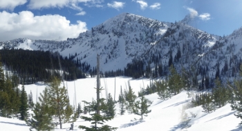
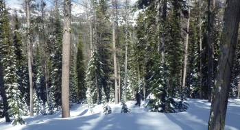
After a wild, narrow snomo run up the North Fork Powder River canyon, you are rewarded with a easy and short skin climb up to Summit Lake. Another bonus is that you pop up into a burn followed by alpine terrain rather quickly for some magnificent views in the heart of the Northern Elkhorns. Some mellow lap skiing can be done in the burnt trees below the lake, while above the lake there is some wicked ski terrain meant for the ballsiest skiers. There really isn't much in-between terrain immediately around Summit Lake but it is an awesome ski tour area with further potential nearby. This would also be an awesome spot for mountaineering.
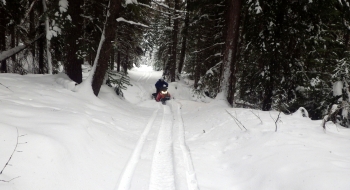
The trick to getting there is to bring a chainsaw. It isn't used much in the winter and the road has become narrow in recent years, so it is prone to down trees, shrubs, and bent over saplings that can make for some slappy riding. While the canyon walls are steep and tall, the avalanche hazard isn't too bad because of the limited snowfall on the eastern flank of the mountains and the ample trees anchoring the snow. There aren't really any evident slide paths across the road from recent years, but they have happened in the past.
For parking, drive up Bulger Flat Lane until it takes a sharp left and that is where the plowing ends. There should be enough room to turn around a trailer there and park on the side of the road, which is plowed fairly wide.


")