Mt. Emily is a popular recreation area during the summer, but in the winter it turns into one of the quickest-to-access snowmobile rides near La Grande. The snow coverage will dictate the route you want to take, or where you park. The mountain can be accessed on Fox Hill or Owsley Canyon Roads. Both are plowed by the county road department, however Fox Hill has a 17% grade and can be dangerous to navigate. Despite this, there are slightly more places to turn around or park on the road, and the threat of avalanches is near none.
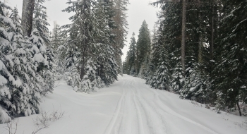
From Fox Hill, it is a ~7 mile road ride to the towers, but don't be disappointed. After large dumps of mountain snow, there are plenty of places to go off road and sidehill or boondock through the trees thanks to current and historical logging operations. If you come up Owsley Canyon, you add another few miles and traverse some avalanche terrain—especially along the road cuts. The 500 spur road connects the Fox Hill & Owsley Canyon routes together. If you're headed to the towers, you can follow Mt. Emily Rd by staying north and not turning west. If the snow is good, I recommend making a loop that can be rode in either direction using the 500 spur, Crampton Rd, and Mt. Emily Rd.
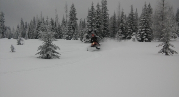
One of the greatest assets of this snowmobile ride is how quick it is to access, especially if you have time constraints. You can make it an all day trip, or a 3-5 hour trip; chances are you will be one of the only people on this mountain. Towards the final ascent to the summit, there are some awesome places to hill climb!
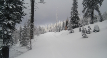
The road continues north, towards Indian Rock, and also cuts back to the south; this is the road that takes you to the summit. Again, don't ride the road if there's good snow; boondock through the trees and enjoy the powder. After a mile or so, the road pops up to the top where several cell phone towers and the Union County emergency services radio repeaters stand. Keep following the road and you'll end up on the summit of Mt. Emily, overlooking the vast quilt-patched Grande Ronde Valley.
By following the 3120 Rd, you'll end up at the warming shelter near Ruckle Junction. The local snowmobile club does maintain the trails here. The road splits in 3 directions: 32 Rd (west), 31 Rd (north), and Ruckle Rd to Summerville (east). From the warming shelter, you can ride trail to Andies Prairie and the Tollgate trails system.


")