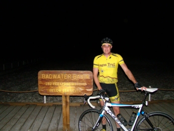
Ride the infamous Badwater Ultramarathon course. It's brutal on a bike too, you just get the pain over with sooner.
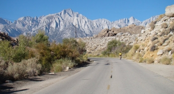
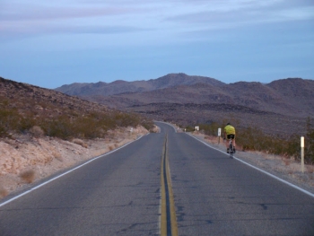
The concept is simple, you start at the lowest point in the North America at 282 feet below sea level. It so happens to also be the hottest point on Earth. Then you travel across the desert for 135 miles and arrive at Whitney Portal at 8,262 feet elevation, which so happens to be the start of the hiking trail that leads up to the tallest point in the lower 48. To pour salt into your wounds, the route throws a teaser at you by climbing 5050 ft. up Towne Pass, only to drop you down the other side losing 3300 feet of you work before immediately starting yet another climb over a pass. The ride through the dessert is awesome and the terrain is very dynamic and big!