Explore trail on map
#GlassHill
#LaGrande
Distance
Trailhead Altitude
Max. Altitude
Min. Altitude
Elev. Gain
Elev. Loss
Average Trail Slope
Max. Trail Slope
Season
May-November

Trail Description

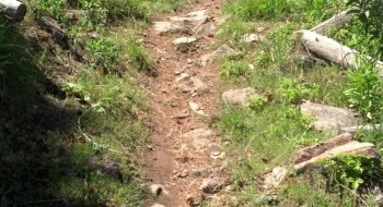
This is the main loop of the original Solstice Triathlon, with a few modification as XTERRA La Grande. It includes signature sections like Suicide, Oshit Hill, and Rock Garden that are rugged and challenging, so you need to stay on your game the whole ride--both physically and mentally. The track shown here is almost entirely singletrack, offering a continuous 6 plus miles of it. It is shown here in the counterclockwise race direction, although it is good the other direction too. (Hopefully we can build an alternate route to climb to the top of suicide.) Note the loops on our EnterActive map that can be made from the other trails in the system.

This is private land, made available for non-motorized recreation by the gracious owners. It is patrolled by Oregon Department of Fish & Wildlife. Please report any suspicious activities to us and be respectful of the property and trail.
Trail data mapped by Brian Sather on Aug 9, 2013 · Last update: May 11, 2021

Waypoints

Lower Meadow

45.276016, -118.093944

Rock Garden

45.271677, -118.086301

Rocky Balboa

45.268839, -118.07732

Oshit Hill — Steep!

45.271299, -118.083703

Meadow Gate

45.278384, -118.100197

Gate Oshit

45.267694, -118.082556

Fence Y

45.267619, -118.080501

Bushnell Meadow Gate

45.264077, -118.072879

The Stile

45.260046, -118.068098

Bushnell Meadow

45.258963, -118.070649

Attempted Suicide

45.256847, -118.075852

Upper Gate

45.263365, -118.086561

Slickrock

45.274217, -118.085919

Suicide Hill

45.250361, -118.073162

Photos

Bushnell Meadow
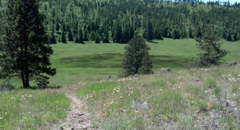
The lower meadow is especially beautiful in the spring.
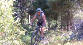
Andy Perry has ridden rock garden a lot!
The beginning of Suicide Hill