Yet another one of the shuttle-able trails at Anthony Lakes (see also Dutch Flat Trail, Hoffer Lakes DH, and Angell DH). The Crawfish Lake Trail (not to be confused with the nearby Crawfish Basin Trail) serves as the singletrack fun that can be shuttled easily from top to bottom on the paved highway on the backside of Anthony Ski Resort. However, the route here is recommended as a longer downhill, a 2600 foot descent from the top of the resort.
There are a few options to initiate this downhill. The first is climbing the road at the ski area to the saddle and then dropping off the backside to begin the descent that includes a fun bermed road of decomposed granite whiteness. It is possible to drive to the saddle with a high clearance vehicle and get dropped off there. Another option once you are on the saddle is to go even higher up to The Lakes Lookout (see Hoffer Lakes DH) and start a bigger descent from there. A third option is to climb the Angell DH) route of the Elkhorn Crest Trail from Anthony Lake, and then take a fantasy route on the Crawfish Basin Trail which ties right into the road going off the backside of Anthony ski area.
Trail Notes for starting at Anthony Lake
- 0.0 mi. Starting at the ski area parking lot, continue up the dirt road.
- 1.6 After climbing 700 vertical feet you arrive at the saddle. From here, it is downhill on the only road that heads downhill. To the left is The Lakes Lookout option. This is also where the Crawfish Basin Trail comes onto the course if you chose that option.
- 3.2 The gravel road comes out onto the pavement. Turn left.
- 3.9 Look for the next left after you have been on the pavement.
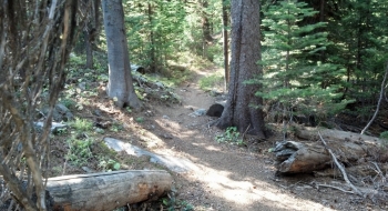
- 4.1 Arrive at the upper trailhead for the Crawfish Lake Trail. Singletrack from here.
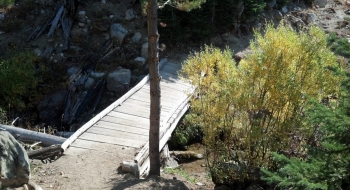
- 5.5 Crawfish Lake. The trail skirts into the wilderness shortly before arriving at the lake.
- 7.2 Finish at the lower trailhead where it connects with the paved road again.