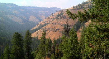
A beautiful trail lays under many down logs along Crazyman Creek, a tributary of the Imnaha River. The logs can be handled, but the trail has two other mortal flaws that need to be addressed before this sweet trail can come back to fruition. The first is that you have the ford the river at the bottom, a task that will be life threatening if done early in the year. The second is that there is no lower trailhead because it is on private land, with fences and gates blocking the way.
The trail starts atop the ridge from Road NF-2965. The trail has decayed where it switches back down a steep ridge, so footing is difficult and the trail hard to follow at times. Once you get down off the ridge you enter the deep forest where the trail surface is good and ready to rip once the logs are cut through. As it gets closer to the Imnaha it becomes more of a grassy road, but for the most part this is a solid singletrack that needs some work for a great shuttle-able descent.

 is one way to drive or bike up to the ridge and catch the trail.")


 be a legal exit/entrance to the trail. You would have to hop the fence here and follow power lines down to the river then find a food fording place.")
