Trail Creek Trail #1883 - Cornucopia, Oregon
Explore trail on map
#Halfway
#Cornucopia
#ClearCreek
Distance
Trailhead Altitude
Max. Altitude
Min. Altitude
Elev. Gain
Elev. Loss
Average Trail Slope
Max. Trail Slope

Trail Description

At one point this would have been a decently long singletrack dropping down from a panoramic saddle on Table Top, but unfortunately the majority of the singletrack has disappeared into oblivion along Trail Creek. I think it should be renamed "Trail Gone Creek." There is even a trail head sign on the Schneider meadow road and the FS maintains information about the trailhead on their website, but there is nothing worthwhile to be found at the old start of the Trail Creek Trail.

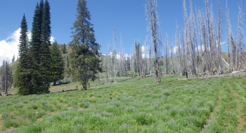
What is left is a sketchy singletrack connector to Clear Creek Trail from a 4x4 road. It isn't too bad of an option to climb up the road though, and pick up the singletrack to get over the top and drop down to Clear Creek. It certainly is a beautiful spot to be, because the visuals are stunning along the approach to the saddle in the ridge. It is also a fun descent because the jeep road has awesome contours and natural features and several launch-able water diversion mounds lower down. Clear Creek would still be a better descent though (if it is maintained) so I've featured this route as a climb. See the EnterActive map for the details on the road network and other trails.

There are also reportedly some ways to do a loop in the swale around the start of Trail Creek. There are a lot of game and stock trails in the area, for sure. It appears you can go a ways on Table Top too.

Trail data mapped by Brian Sather on Jul 6, 2016 · Last update: Dec 10, 2016

Waypoints

Trail Disappears — At this point the trail turns into a number of elk and game trails. Sticking with the traditional trail surface will take some re-establishing. The track from here to Clear Creek Reservoir Dam is somewhat speculative. You basically aim for swinging just below the rocky drops above the lake.

45.05683, -117.16147

Spring & Water Trough

45.05092, -117.16442

Trail End at Clear Creek Reservoir. — In case you get lost.

45.06146, -117.15127

Photos

View toward Clear Creek from the saddle.Looking down toward Pine Valley to the south. The trail coming down the east side of the ridgeLots of elk.Here is the worthless road to the official trailhead at the bottom.
Looking uphill from the beginning of the singletrackThe trail switches back and diagnols across the ridge. Trail starting to disappear.  Just past this point is where the trail gets difficult to find. If you take the trail as a downhill, this is what you see.A beautiful road. The old beginning of the Trail Creek Trail.
Some challenging, but awesome geological features on the trail. Look for this water trough as a reference point because the trail goes right by it. Some snowmobile debris shows the evidence of the winter popularity of this area.Some fun features beside the 4x4 road can be included in freeride.The 4x4 road is fun.No sign of a trail along the creek.
Looking toward Red Mountain from the trail. At the saddle, looking west.Elk calves. Flowers out on the 4x4 road in July.This trail sign is false advertising on the Schneider Meadow road, just past the bridge over Clear Creek.