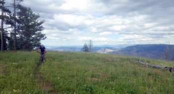
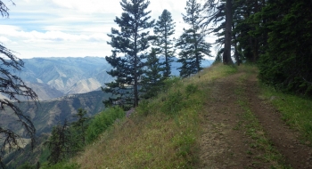
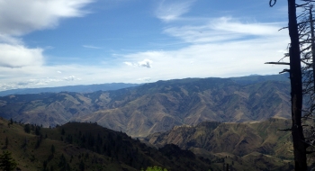
This route offers a grandiose view of the signature canyon of the region, both rugged and remote. On the road at Warnock Corral, there is a gate that is closed to motorized use during archery season but open for 4WD access the rest of the summer season. It is a relatively good quality dirt road that takes you along the scenic rim overlooking the deepest canyon in North America, Hells Canyon. This road goes all the way out to an active backcountry airstrip at Lord Flat where you hit the Wilderness line and motorized vehicles are no longer allowed to travel beyond that point. Even though it is a primitive road, it is featured as a mountain bike route because it is steep in places and very rugged. There is also some potential for looping some singletrack side routes. Because of this, a mountain bike should be the bike of choice, ebike even better. You'll really enjoy the ascetics of this ride as you charge along at the top of the world through native grass, previously plentiful timber, wildflowers, wolves and other notable wildlife.
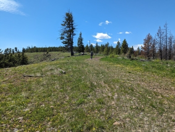
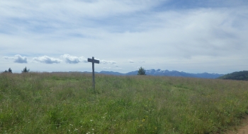
There are a series series of about three roller coaster drops and climbs about 5 miles out before getting to Ninemile Saddle, but otherwise the rest of the route is undulating with a gentle elevation decrease. Before getting to Lord Flat, another feature is the Dorrance Cow Camp, where an old cabin and other structures are still actively reserved from the Forest Service. There are several primitive camp spots along the way, mainly used by hunters in the fall. Aside from a few sparse springs, there isn't much for water so plan accordingly. The trail does continue on after Lord Flat, but since it has gone under Wilderness it hasn't seen the usage it once did. The singletrack trails mentioned earlier are not used much and are in disrepair, but there is potential! You roughly follow the Wilderness line the entire way, so everything to the right (east) goes into Wilderness and to the left is not.
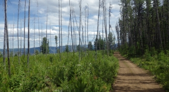
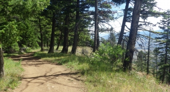
The 2022 Double Creek Fire devastated about all of the timber across the entire ridge between the Imnaha and Snake rivers. Many of the pictures here were taken before the fire.
Getting There
The road is gravel with a narrow and precarious climb from Imnaha up to Buck Point and then it levels out heading toward Hat Point. Instead of going to Hat Point you stay left and head toward Warnock Corral on a road that is labeled Temperance Creek. This road is good until about 2.5 miles from the corral and then it gets rough so you can decide to press on to the official trail head or park anywhere and start riding.