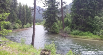
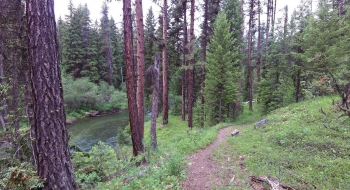
A very long and scenic riverside trail along the Minam River. We don't have a lot of trails that follow a major river in this region, but this one hugs the river magnificently for many miles, all the way to the headwaters at Minam Lake (although here we are just featuring the trail to the footbridge at Red's Horse Ranch). The problem is that the trail isn't well maintained and it is a complete cluster to access.
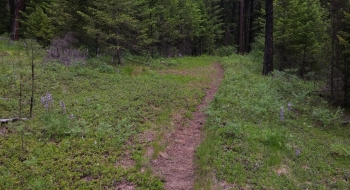
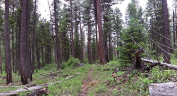
The trail surface is in great shape and the brush isn't too thick either, it is just the trees across the trail that hamper progress. As a hike it won't be too bad, except that it is very long and difficult to get to where the single trail starts at Meads Flat. So, I recommend using a bike to get to Meads Flat or maybe a little further and then go on on foot from there. Getting to Mead Flat, which is the old trailhead, has plenty of impediments. The best way is to start on the highway near the top of Minam Grade and ride down a gravel road to cross a bridge and then ride up the gravel road to Meads Flat. It is a scenic ride along the river. You can't block the gate up top, so you'll have to figure out some type of parking down the road or across the road. The other option is to go to the trailhead just off the highway at the bottom of Minam Grade. This trailhead is unmarked on the highway and is a tough turn onto a dirt road that puts you down where you can ford the river when the water gets low enough. Then, you have some singletrack for a while before you join a road that takes you up to Meads Flat. The other way to get there used to be to take a vehicle up Deer Creek and around and down Squaw Creek but within the last couple years Hancock has put up gates, so forget about that option.
The trail does have some up and down to it where it has to get up some banks when the canyon walls are steep, but for the most part it is a gentle rise. You pass some lesser-used trails right away and then it gets more remote. Eventually you come to where the Little Minam Trail comes into it, which is also a river ford. There are a couple options for that. The next stretch gets surprisingly open and wide, perhaps an old road from when widespread land rapage was happening. The forrest is well spaced and park-like as you make the final run to the Minam Lodge and Red's Horse Ranch area. You'll hear the river rushing your entire trip.