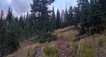
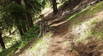
This is an uneventful but awesome trail that shoots straight up Squaw Creek to the China Ridge Trail. The beauty is its simplicity marching through a low use area with direct access into a remote area. The climb is subtle and direct and makes good time getting up to some nice scenery. The trail is in good shape too. You stay in the big trees on the west side of the creek until you cross the creek and the visuals open up as you work directly toward the saddle. After crossing the creek you are in meadows for a short ways that are soggy and full of stinging nettles. When you get to the saddle, the trail splits to go either way along the China Ridge Trail. The saddle is a gentle one, with some nice views into the upper Minam the peaks and ridges around the area.
There are some oddities about this trail though. The access is weird and there is no good parking space at the trailhead, let alone a good spot to turn a trailer around. The Forest Service must have intended for the access to be from Buck Creek Trailhead because there is a trail junction up from there that shows trail 1951 starting and maps correspond with this. But that is an odd way to do it since you drop down a steep trail, cross Middle Fork Catherine and Squaw Creek, and then come up to a road--all of which have no signage or direction. Then, you would have to go up the road a ways to connect with a trail again. This all doesn't make sense as a single trail, especially since a few years ago a bridge was put in at North Fork Trailhead and Campground and you can drive up this road with a passenger car, including driving along the official 1951 trail and then getting to the trail start as it is featured here. In summary, the 1951 trail really starts as we show it here, just don't expect more than a couple cars to comfortably park near the trail start, and avoid bringing a trailer up (although it is doable). We have the other trail fragment featured on our map if you want to see it.
There aren't any trail signs to speak of, but there is a sign from the Catherine Creek Road at North Fork that points you across the bridge and says 3 miles to the trail. I'm not sure if this is referring to the distance to the trail that comes up to the road at an unmarked place, or higher up where the trail takes off from the road again at an unmarked trailhead. What you're looking for is this upper one, which is where the road takes a sharp left-hand hairpin bend. The road gets rough after that and eventually ends, so it is pretty distinct. The trail takes off from the road very steeply at the start then mellows.
Trail Notes
- 0.0 mi. Start from trailhead. There is not trail sign, but the trail heads steeply off the road on the upper side of the road switchback.
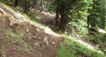
- 1.4 Trail crosses Squaw Creek and continues on the open east side of the creek where there are some erosion issues.
- 2.7 End of the trail where it meets China Ridge Trail. Left goes to the North Fork Catherine Creek Trail via Meadow Mountain and right goes to the Elk Creek Trail via China Cap Pass.


")


