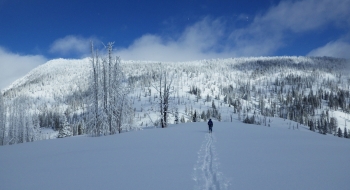
This unnamed ridge seems to get the brunt of winter storms, and provides a variety of ski options on all sides of the ridge. Low angle slopes on a burn allow for wide-open tree skiing with lower avalanche danger on much of the western aspect. Slopes to the north on the ridge are steeper with longer downhill options. See the Mule Peak Lookout to the North and get a glimpse into Olive lake and Echo Lake from the ridge.
The route shown here is a sample loop using the most direct access to the ridge and then skiing some steeper NNW aspects.
Access
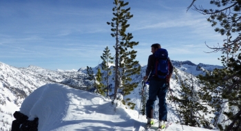
Snowmobile: Park at the SnoPark at Catherine Summit on Hwy 203. A permit is required. Follow Rd 77 east on snowmobile to the warming cabin at Taylor Green. The snowmobile ride is on groomed trails and then some ridgetops up to Flagstaff Butte and beyond. Take your sled past Taylor Green and then look to access Flagstaff Butte which has a visible radio tower. There are several ways to access this but the easiest is to stay on the groomed trail until you have come around to the southeast of the butte and follow a road up the ridge. Stay on the ridgetops as you progress toward the burn. See pictures for the one crux ridge that might not be worth messing with if snow is deep or cornices are big. If you can get past it and up to the wilderness boundary, that will save about 30 minutes of skinning. Park sleds at the wilderness boundary just before getting to the slope.

 and look to park there or drop off the other side. Watch of cornices.")


")