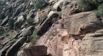
Mix in a couple steep, difficult, but shortish climbs with very fun and technical descents and you have the Sovereign Trail of Moab. The trail travels through the green, uranium-mined hills north of Moab. The singletrack climaxes with a taste of slickrock and ripping fast wash riding. Along the way, there are several extreme drops and stair-like ride-ups. In short, the trail throws a lot at you, so stay on your toes.
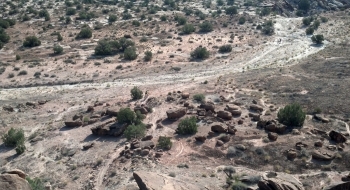
The loop here is shown starting at Dalton Wells, where there is an open parking area. This avoids driving through several sandy washes out to the official trailhead. Most passenger cars should avoid driving through these washes. The trail ends at another parking area near the south of the mapped track above, and the loop can be finished with a ride through some more washes and a short trip back on the highway. Parking at either trailhead is also an option for high clearance vehicles.