This is a rough trail that drops through 2 canyons and gains a ridge on the other side. It is a good mountain run or hike, but pretty narrow and grassy on the flanks of Swamp Creek. The Davis Creek sections are more used and open. You can drive to both ends of the trail, so it would work as a good traverse or for use in accessing or leaving the Davis Creek or Swamp Creek trails. The top of Starvation Ridge crosses a narrow primitive road and offers some nice views of the Wallowas to the south.
The west ends of the trail is well established with a good trailhead just off of Highway 3. The east end is not well traveled at all and difficult to follow in the last 1/4 mile. The trailhead is difficult to find too.
Trail Notes
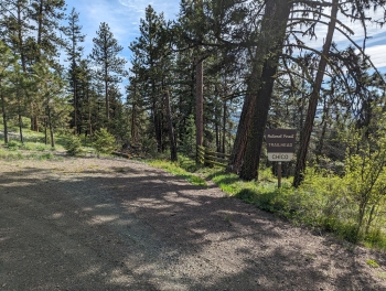
- 0.0 mi. From the Chico Trailhead go through the gate and head down the trail.
- 1.1 Arrive at Davis Creek. Cross the creek and start up the trail that heads up the hill abruptly (avoid going on the more well established cow trail along the fence).
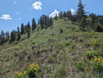
- 1.8 Top out the ridge and cross a jeep road and head over the other side. You should be able to see the Chico Trail zig zagging up the ridge on the opposite side of the canyon.
- 3.2 Arrive at Swamp Creek. Ford the creek and head south through the meadow and then head up the hill to the left of the cabin. The trail can be difficult to find in this area. There are some trail signs by a gate, where you will head up the mountain and find the more established trail.
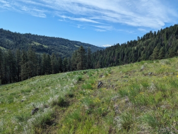
- 4.5 The trail begins disappearing. You basically follow the south side of the ridge until you get to the top.
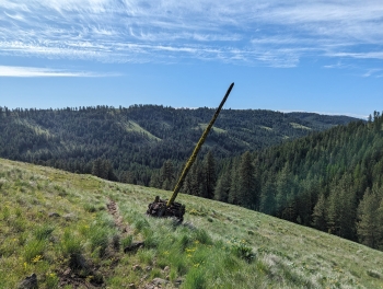
- 4.7 The trail goes through and opening in the fence and comes to the road where an old trial sign exists.