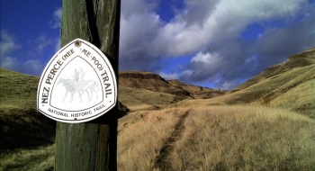
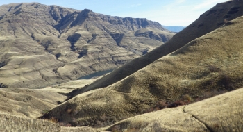
Based on historical significance and rugged beauty alone, this trail ranks as epic. As a pure mountain bike trail it is rather short and not built too well for riding. The journey begins with a long bumpy dirt road drive out past the Cow Creek bridge that crosses the Imnaha River. You then continue on the road toward Dug Bar until you find a trail sign on the right with the markings for Nez Perce Trail.
For most of the climb up to Lone Pine Saddle I was pushing my bike. Instead of thinking, "This sucks pushing my bike up this trail," I thought this is nothing compared to the suckage the Native Americans must have felt being forced to permanently leaving the beauty of their land around Wallowa Lake. I won't go into detail on the history of the event, because it is well storied elsewhere. However, I did feel the emotion of the spirits sans the obligatory eagle screech sounds. Perhaps the spirits were embodied in the heard of elk I rode below after rounding the corner and traversing toward the Snake.
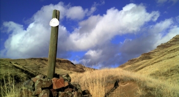
Be prepared for an unbelievable amount of goat heads and rattlesnakes. Still, this isn't near the level of suckage the Nez Perce were experiencing so it is well worth attempting this journey on a bike. Even if you double flat, you ought to finish it. Some recent digging work has been done on the trail, and it is well marked with signs every quarter mile or so. From a navigation standpoint, you really can't get lost. You may want to just ride back on the road to make a scenic loop of it. The road is 7.5 miles back to the trailhead.