This is an abrupt, short and steep trail that takes you from Swamp Creek Trail to Miller Ridge. The bottom part does not follow the original trail, but has been cleared for an ATV to go up. You basically follow the creek bed, but about halfway up, there is a cairn which begins a series of switchbacks up to the top of the ridge where a trail meets a road.
It is rough enough that only hiking and mules should probably try this trail.
Trail Notes
- 0.0 The trail starts from the Swamp Creek Trail and is marked by some rocks on stumps. There isn't much of a well defined trail at the start, but more of evidence where an ATV has gone straight up the draw and, thankfully, cut its way through the brush. You can follow bottom of the draw.
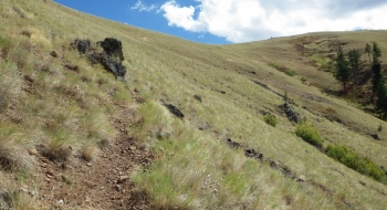
- 1.0 Look for a cair to mark the trail departing the draw to the left heading sharply up the mountain for several switchbacks before one long traverse up to the ridge.