All
Summer
Winter
All Activities
ATV Beginner Big Ride Dirtbike Fantasy Gravel Bike Hike Mountain Bike Nordic Ski Race Road Bike Summit
All Areas ATV All Singletrack Andies Prairie Aneroid Angell Angell Basin Anthony Anthony Lakes Arizona Baker Baker City Bear Creek Bear Lake Bear Springs Trap Bearwallow Ben Point Bend Bennet Peak Big Canyon Big Sheep Billy Jones Birdtrack Springs Black Lake Black Mt. Blue Lake Blues Boise Bone Springs Bonny Lakes Boulder Park Boulders Boundary Boundary Campground Bourne Bowman Brand Trails Breshears Brown Mountain Brownlee Buck Creek Buck Creek Campground Bulger Flat Burger Burger Meadow Burger Pass Cached Lake California Camp Carson Carper Carson Cascades Catherine Catherine Creek Catherine Creek State Park Catherine Meadow Central Oregon Chicken Hill Chico Chief Joseph Peak Chimney Lake China Cap Clear Creek Clear Creek Snopark Clear Creek Warming Shelter Climb Coeur d'Alene Copper Creek Cornucopia Cornucopia Peak Avalanche Cougar Ridge Cove Cove Wash Cracker Saddle Crib Point Cuddy Culver Lake Davis Creek Deadman Trail Death Valley Diamond Lake Dirt Climb Dobbin Dug Bar Dutch Flat ECT Eagle Cap Eagle Cap Wilderness Eagle Caps Eagle Creek Eagle Forks Eagle Lake East Eagle East Fork Pine Creek East Peak Echo Echo Lake Elgin Elk Creek Elkhorn Crest Trail Elkhorn Peak Elkhorns Enterprise Fake Creek Falls Creek Family Fergi Fergie Fish Lake Five Points Flagstaff Flagstaff Butte Flora Florence Foothill Fox Hill Frances Lake Frazier Lake Freezeout Saddle Galena Glacier Lake Glacier Peak Glass Hill Goat Creek Goat Mountain Goodrich Lake Grande Ronde Valley Granite Granite Gulch Green Lake Greenhorns Greer Greer Ranch Haines Hale Spring Halfway Harris Park Hat Point Hells Canyon Hidden Peak Hideaway Spring High Hat Hoffer Lakes Hood River Huckleberry Mountain Huntington Hurricane Creek Ice Lake Idaho Imbler Imnaha Imnaha River Indian Creek Indian Crossing Indian Rock John Henry John Henry Lake Joseph Joseph Canyon Joseph Creek Jubilee Lake Jumpoff Joe Lake Ketchum Killamacue La Grande Lackeys Hole Ladd Canyon Ladd Marsh Lake Creek Lakes Basin Lakeys Hole Lapover Legore Lake Lehman Hot Spring Lick Creek Lime Quarry Little Bear Little Bear Creek Little Eagle Little Minam Lodgepole Long Lake Long Ridge Looking Glass Lake Lookingglass Lookout Mountain Lord Flat Lostine Lowry Gulch Luger Springs MERA Main Eagle Marble Pass Matterhorn Maxwell Lake McBride McBride CG McCully Meacham Divide Meadow Mountain Meads Flat Medical Springs Mill Creek Minam Minam Lake Minam River Miner Lake Mingletrack Mirror Lake Missoula Moab Montana Morgan Lake Moss Springs Mt. Emily Mt. Fanny Mt. Harris Mt. Howard Mt. Moriah Mule Peak Murphy Creek Murrieta Nevada New Bridge New Meadows Nez Perce Ninemile Trailhead North Fork John Day North Minam North Powder North Powder River Norton Lakes Norway Basin Ochocos Olive Lake Ollokut Ollokut Campground Oregon Coast Owsley Oxbow PJ Pacific Crest Palmer Junction Park Saddle Pendleton Phillips Lake Phoenix Pine Creek Point Prominence Polaris Pass Pondosa Pop Creek Pop Lake Powder River Prairie Creek Prairie Lake Price Prineville Pt. Prominence Race Course Razz Lake Red Mountain Reds Horse Ranch Richland Riverside Park Rock Creek Rock Creek Butte Rock Springs Roundabout Spout Ruby Peak Ruckel Sacajawea Peak Saddle Creek Salt Creek Summit Salt Trail Sand Pass Santa Clara Schneider Cabin Sedona Shady Sinks Sled Springs Smokeys Snake River SoCal Sparta Spout Springs SpoutMTB Spring Creek Spring Mountain Squaw Butte Squaw Creek St. George Standley Guard Station Standley Ridge Stanley Starkey Steamboat Lake Sugarloaf Summerville Summit Summit Lake Summit Point Sumpter Sun Valley Swamp Creek Swamp Lake Syncline Table Rock Taylor Green Telocaset Temecula Tenderfoot The Dalles The Lakes Lookout The Watershed Thief Valley Reservoir Tollgate Tombstone Lake Trail Creek Trailwork Trailwork Needed Traverse Lake Trout Creek Troy Tubbs Hills Twin Lakes Two Color Two Color Lake Two Pan Ukiah Umapine Umatilla Umatilla Forks Umatilla Rim Umatilla River Union Unrideable UofM Utah Van Patten Walla Walla Wallowa Wallowa Lake Wallowa River Wallowas Walton Lake Washboard Washington Wenaha West Eagle Wilderness Williams Creek Wing Ridge Wolf Creek Young Ridge Zumwalt downhill road run test
MAX. DISTANCE: Any
4 trails matches your filters
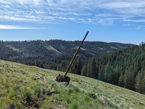
This is a rough trail that drops through 2 canyons and gains a ridge on the other side. It is a good mountain run or hike, but pretty narrow and grassy on the flanks of Swamp Creek. The Davis Creek sections are more used and open. You can drive to both ends of the trail, so it would work as a good...
Explore full guide
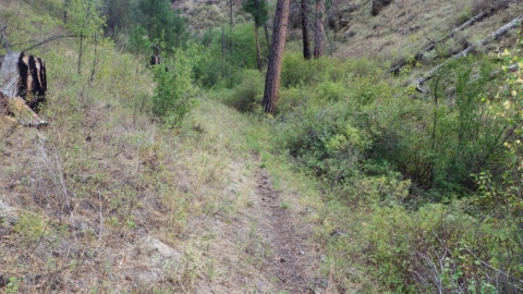
This is an abrupt, short and steep trail that takes you from Swamp Creek Trail to Miller Ridge. The bottom part does not follow the original trail, but has been cleared for an ATV to go up. You basically follow the creek bed, but about halfway up, there is a cairn which begins a series of...
Explore full guide
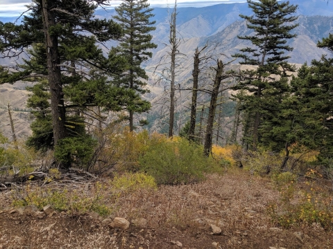
The dramatic view of The Seven Devils of Idaho and Hells Canyon between will entice you to experience it on trail, and this one takes off right from the Hat Point Lookout day use area. It drops you into the deepest river gorge in North America with a series of switchback through a relatively recent...
Explore full guide
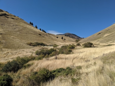
This trail somewhat links the Hat Point Trail to the Snake River in the most direct manner possible. The route of both trails combined, do an amazing job to diminish the steepness on the drop into North America's deepest river gorge. While the Hat Point Trail is in good enough shape, the Hat Creek...
Explore full guide


