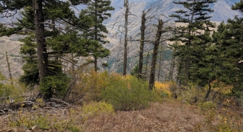
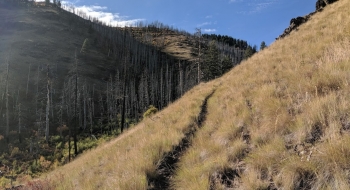
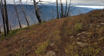
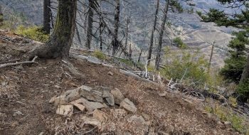
The dramatic view of The Seven Devils of Idaho and Hells Canyon between will entice you to experience it on trail, and this one takes off right from the Hat Point Lookout day use area. It drops you into the deepest river gorge in North America with a series of switchback through a relatively recent burn and then a more direct path down a ridge to a geographic feature known as "The Benches." At this point the trail ends at an intersection of a few other trails. It is a nice big grassy bench with some timber and a beautiful place to hangout or camp.
Unfortunately the trail suffers from the post-fire brush and blowdown, but otherwise the trail is distinct and fairly good. It does cross Hat Creek a few times, which flows most of the year, but don't expect much for water on this trip. There is a lot of wildlife in this area and a lot of open line of sight, so the entire trip should be visually stimulating.
The trailhead is right beside the cabin used by the lookout attendant. The lookout is staffed from July to late September. There are some campgrounds nearby or you could camp near the trailhead, but it is a very windy area so you may want to find somewhere out of the wind. The road from Imnaha to Hat Point is about 24 miles and often rough. High clearance vehicles aren't necessary, but the climb is very steep so pulling a trailer or other heavy equipment should use caution especially on the descent back to Imnaha.